Learn why our work is important to understand future sea level changes

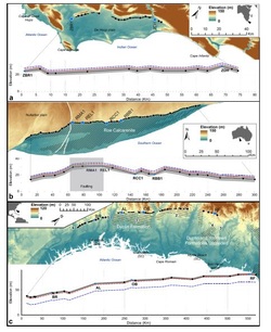
Spreadsheet containing the positioning of the mid Pliocene shorelines described by Rovere et al., 2014, EPSL, and results of GIA modelling.
|
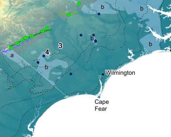
GIS datasets, including location and photos of the Mid-Pliocene shoreline in the US East Coast, Rovere et al., 2015, ESR
|